Messing around with weather satellites
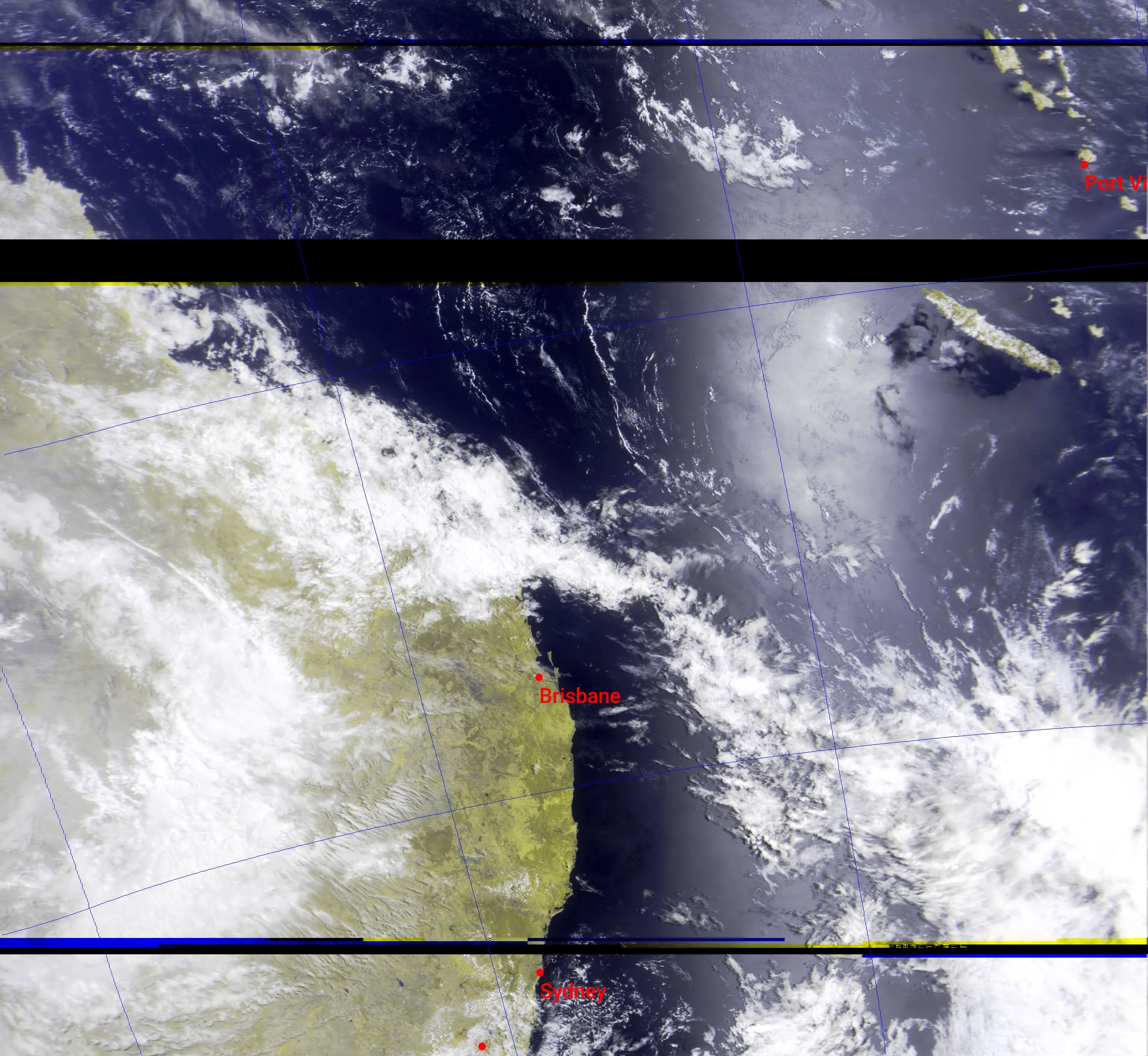
Recently, I have made a hobby out of pulling images from weather satellites. The first image below shows the best image I have been able to get so far. It was taken yesterday (01/12/23) at around 8am from the recently launched Russian weather satellite ‘Meteor-M N2-3’, which was launched on the 27th of June this year.
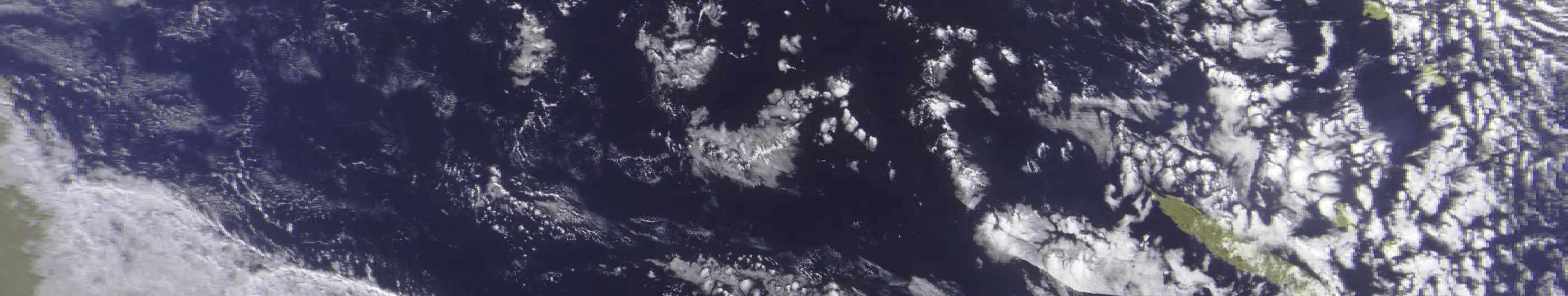
I did manage to download an image from it only 10 days after it launched, however I didn’t get a good signal and only managed to get part of an image. This can be seen here:
Unlike NOAA satellites, its much more ambitious on what frequency and data rate the Meteor satellites will be transmitting on. This is because it switches between 137.1 and 137.9 MHz along with its 72k and 80k modes to avoid transmitting over various NOAA satellites. For Australia, I have found that it transmits on 137.9 MHz and uses its 72k data mode on LRPT.
Speaking of NOAA satellites, I tend to capture these more because they fly over quite a bit more frequently. However, since I don’t currently have the capability to receive any other image transmission besides APT, (a 1960’s technology), the images look quite a bit worse, but still can be impressive at times. Since APT is an analogue technology, it’s data rate is a LOT lower, meaning it has to send down lower quality images. This means that unlike Meteor where you either get a high-quality image or nothing, images from NOAA satellites can get quite noisy / grainy and lead to the image not all looking clear. Here is the best image I have been able to get so far:
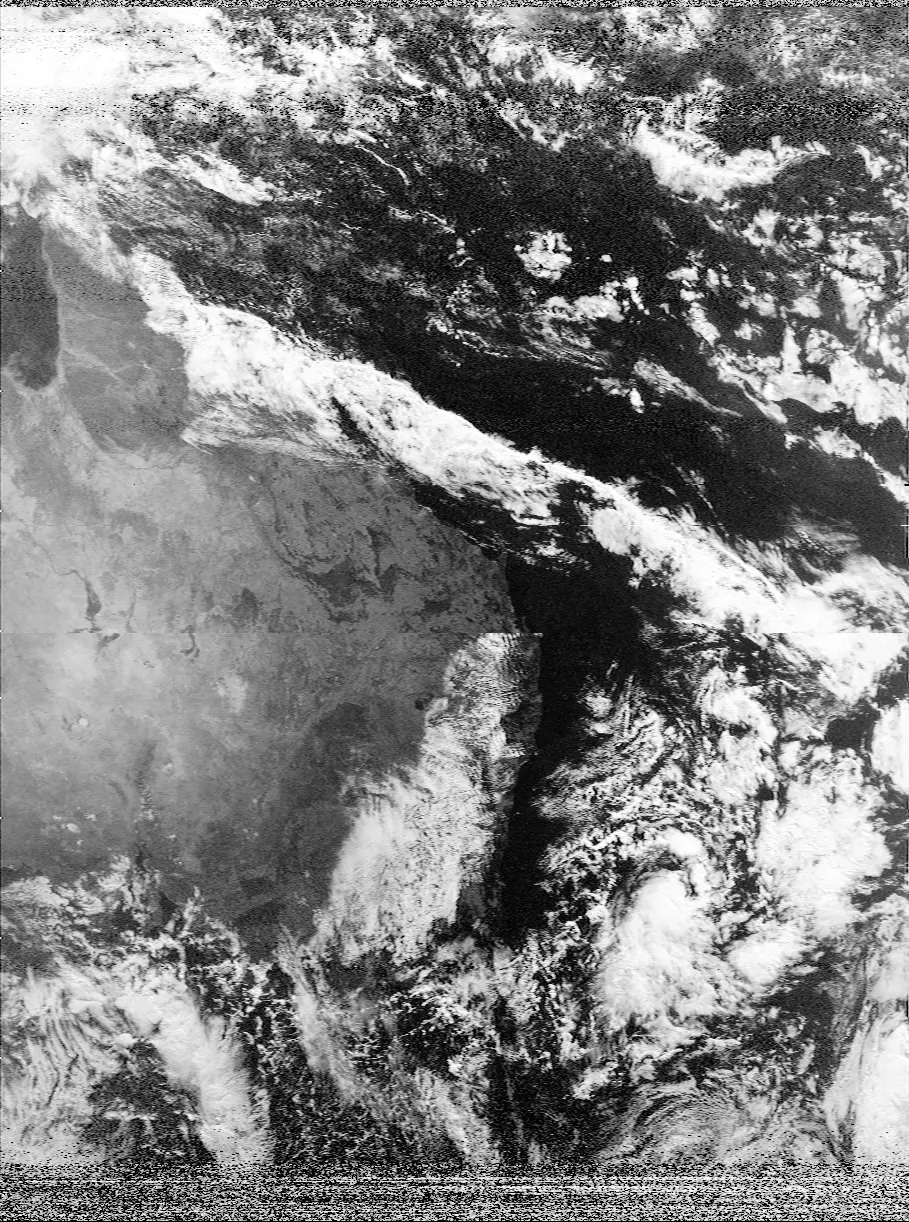
Side note: (My computer went to sleep while it was processing the middle of the image, causing there to be a jump)
To do all of this satellite work, I use an amazing program called SatDump in which you can record and decode all of the passes. They also have a really useful website where you can see the frequencies of all of the different satellites that it supports. Along with this software, I use an RTL-SDR along with its stock dipole antenna kit to receive the transmissions.
Overall, this was and continues to be a really fun project, and I could not recommend it more if it is something you want to try out. Right now, I’m working towards being able to connect to geostationary satellites like GK2A to get some images of the entirety of Australia. I’m also working towards getting a system set up where all of these passes are recorded automatically, essentially creating a satellite-based weather station.